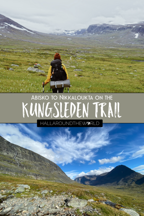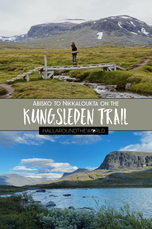
Kungsleden Guide - Trekking from Abisko to Nikkaloukta in Swedish Lapland
Originally posted January 2, 2021
Since returning from Sierra Leone in March, I, like the rest of the world, more or less stayed at home… and, though the time spent slowing down and reconnecting with friends and family virtually was nice… by late summer, I was beyond ready for a holiday.
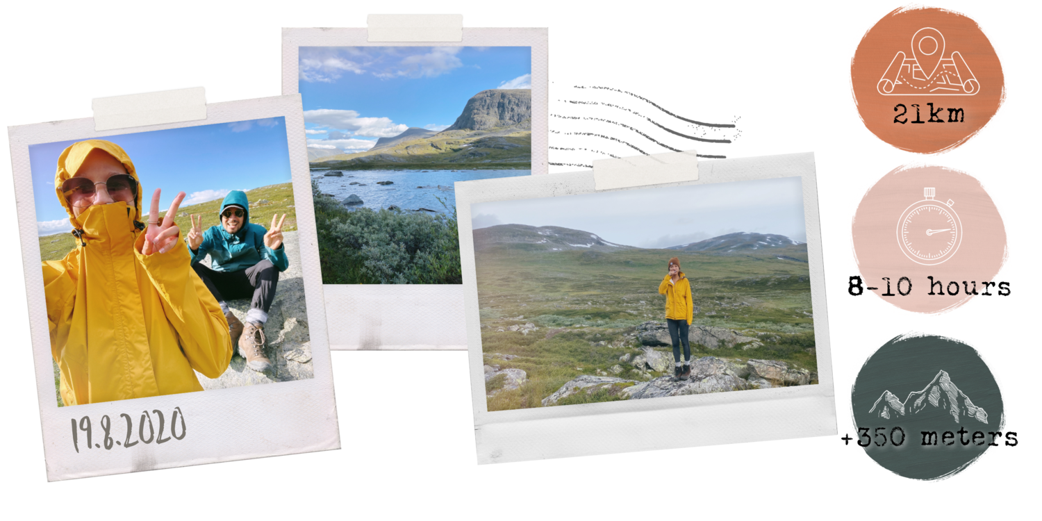
A lot of countries in Europe had opened up for tourism, but instead of jetting off somewhere else, Andrew and I decided to keep our summer holidays in Sweden (and to put a big check on our bucket lists).
The night we met, (at a random salad joint in Seoul, South Korea), Andrew mentioned wanting to go to Swedish Lapland, and after moving here and swooning over photos, it was high on my list as well. We finally decided to make it happen, and spent our summer holidays trekking Swedish Lapland’s epic Kungsleden Trail - or in English, The King’s Trail.
If you’re interested in the great outdoors and sustainable travel experiences, keep reading for a complete Kunglseden Guide covering everything you need to know about trekking from Abisko to Nikkaloukta.
This article will cover:
Getting There
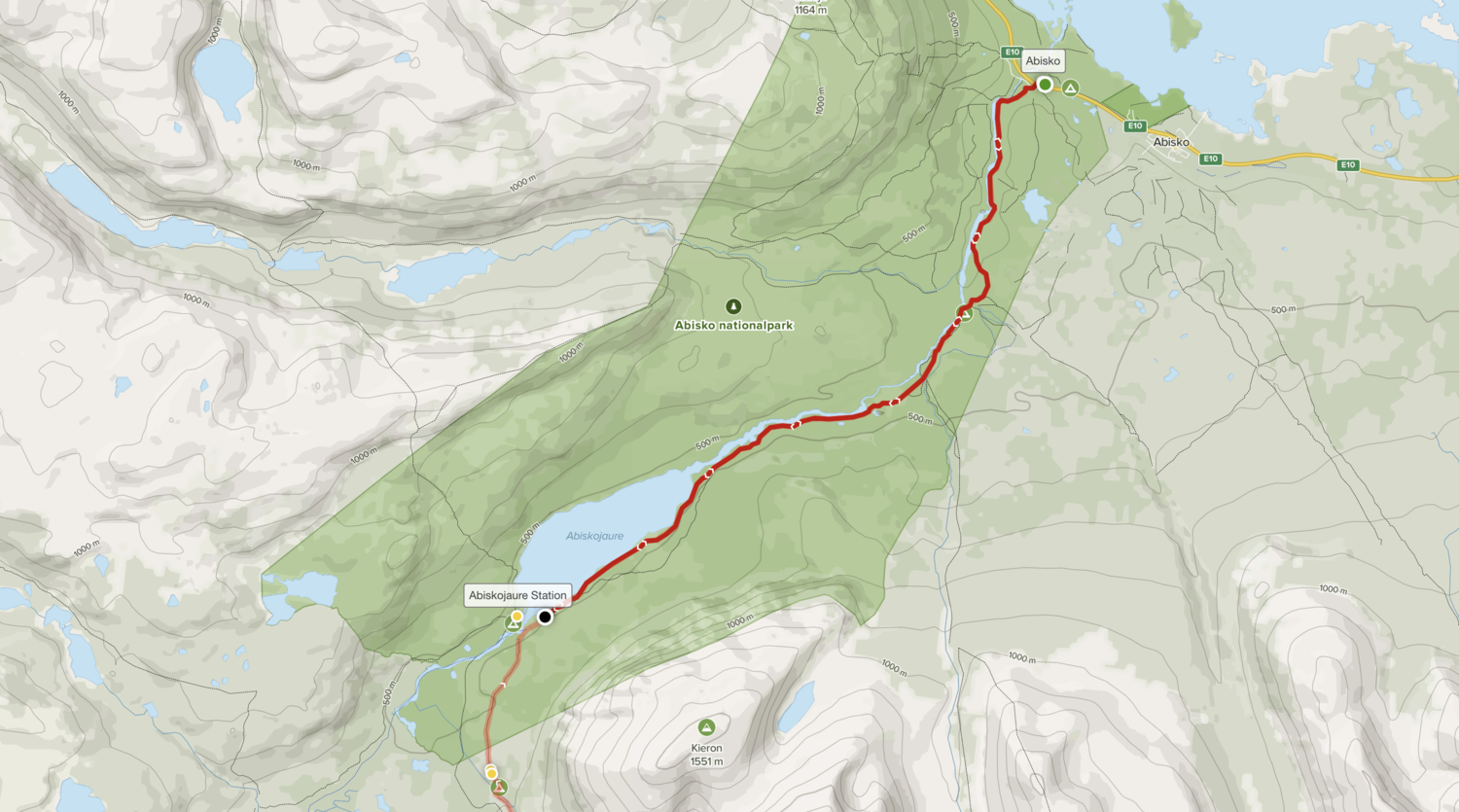
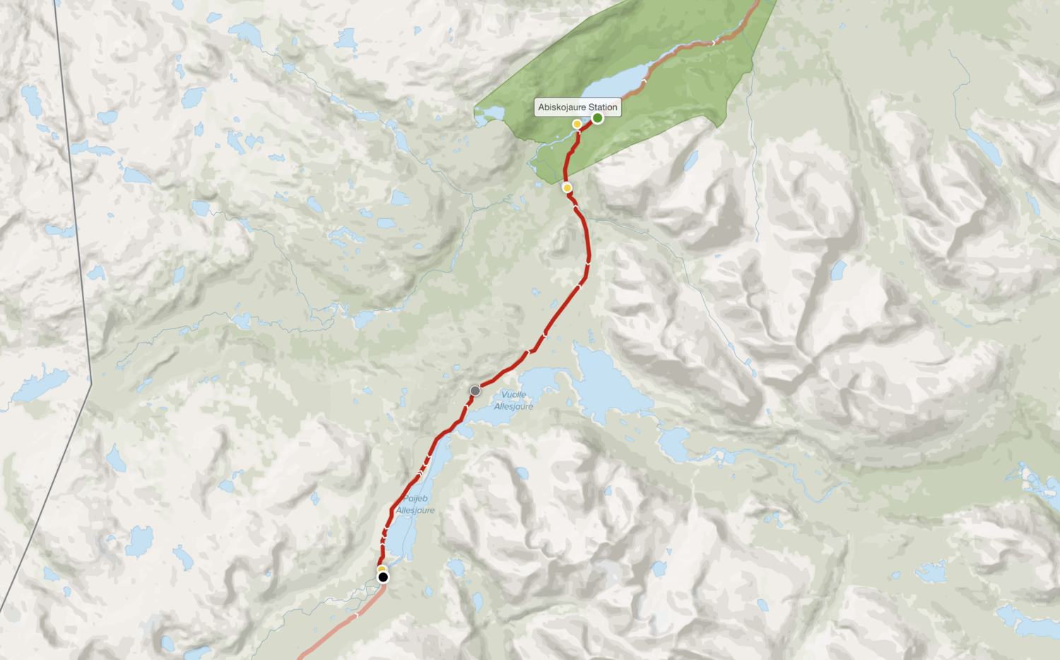
Day 1 – Abisko to Abiskojaure
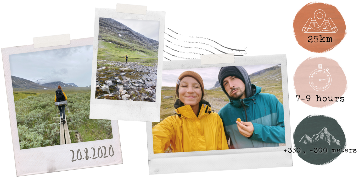
Day 2 – Abiskojaure to Alesjaure
Boat from Alesjaure Outlet to Alesjaure Fjällstuga
Accommodations: STF Alesjaure Fjällstuga
Day 3 – Alesjaure to Sälka
Accommodations: STF Sälka Fjällstuga
Day 4 – Sälka to Kebnekaise
Day 5 – Kebnekaise to Nikkaloukta
Helicopter Ride with Kallx Flyg
Accommodations: Nikkaloukta Sarri AB
Day 6 – Nikkaloukta to Kiruna
Accommodations: SPiS Hotel and Hostel in Kiruna
STF Memberships
Adventures on Film
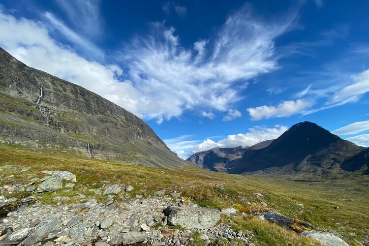
About the Kungsleden Trail
The Kungsleden passes through three national parks, stretches north of the Arctic circle, and is one of the least populated areas in Europe – aka… it was the perfect place to get outside, off the grid, and disconnect after months spent scrolling indoors.
Added bonus - social distancing had never been easier.
Also, it’s absolutely beautiful.
Though you will likely find yourself in a national park or two, this is no walk in the park. You’ll want to be prepared because it is a pretty big challenge. Having the right gear is SO important.
Looking for gear recommendations? Check out the gear guide for a list of everything we packed for our thru-trek (and a few things that we didn’t).
How do I get to the Kungsleden Trail?
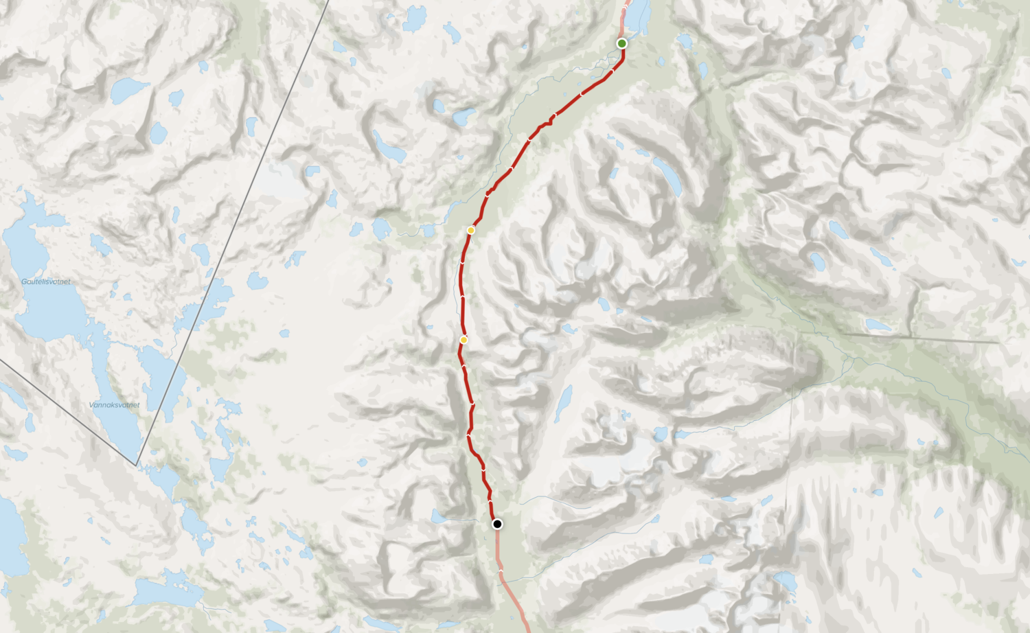
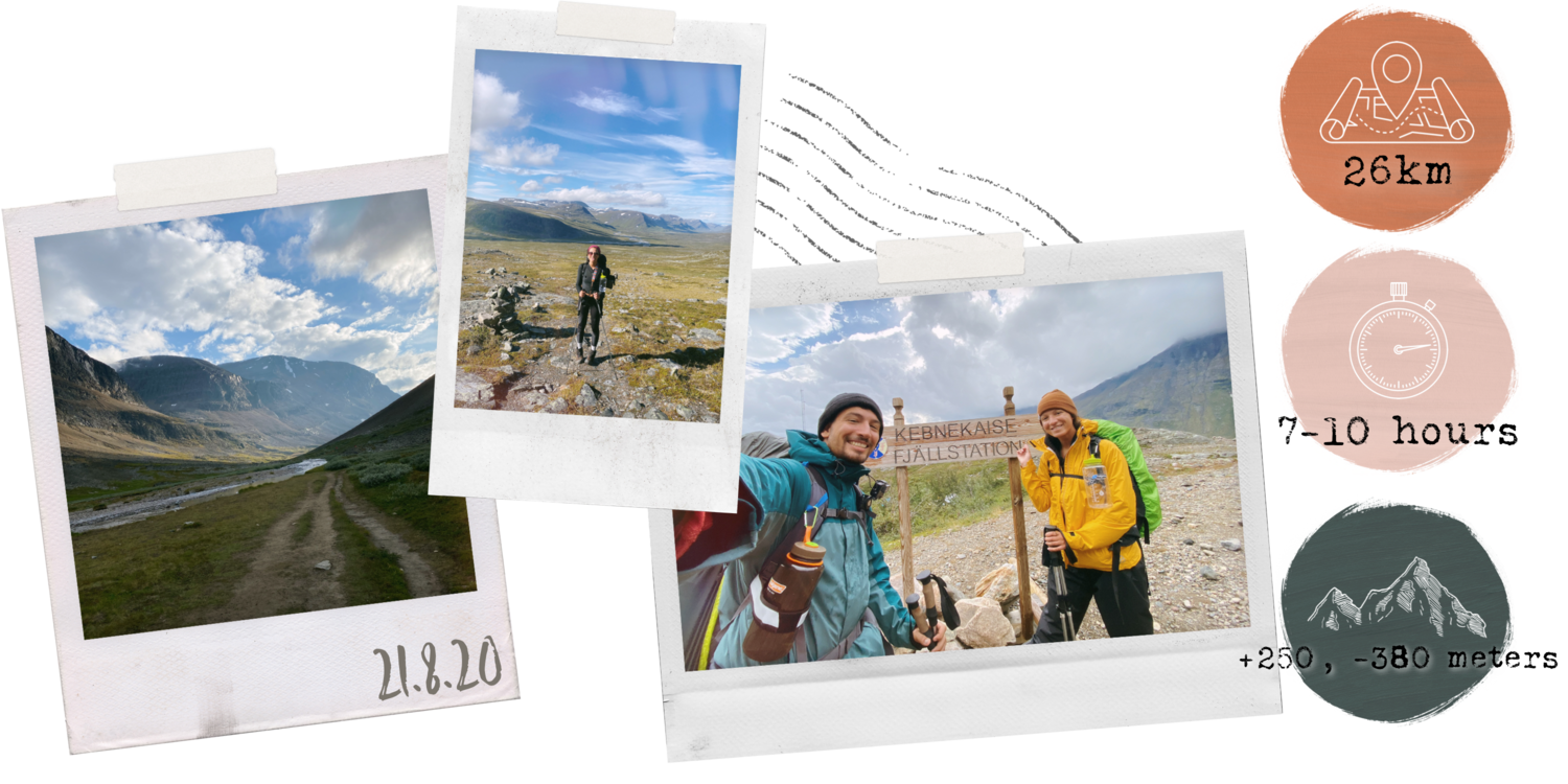
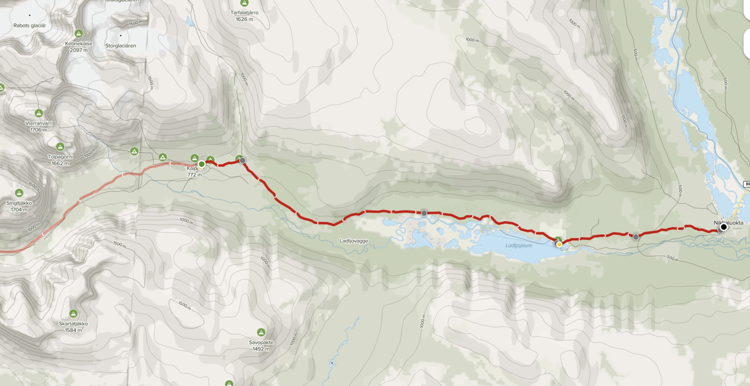
There are several different entrance points along this section of the trail at Abisko, Nikkaluokta, Vakkotavare, Saltoluokta, and Kvikkjokk. Unfortunately, we only had time to go from Abisko to Nikkaloukta… and somehow managed to do so in five days.
This Northern portion of the Kungsleden is easily the most popular, and for good reason!
It is absolutely beautiful!

In hindsight, I would NOT recommend going at such a fast pace, and wish we had taken a bit more time along the way… but with a full two days to even get there and back, and no paid vacation days (the downside to teaching online) we had to get back home. The weather also turned pretty abysmal on our final couple of days, so it was a good thing we finished up when we did.
You have a few different transportation options to get there - by plane, by car, or by train.
The Kungsleden is a through-trek, so you can start at Nikkaloukta and work your way up or go to Abisko and go south. We started in Abisko (so the following info applies to getting there), but, if you start from Nikkaloukta, it is similar. The only difference is that you will need to fly or take a train to Kiruna and then a bus from there to Nikkaloukta.
BY CAR
A car trip from Malmo would have taken us about 25 hours, which is about the same duration as taking the overnight train (but much pricier in terms of fuel… and a lot less eco friendly). We also don’t have a car… so there’s that…
BY PLANE
Depending on when you’re travelling (high season/low season/weekends/weekdays), flights can be either be super affordable or extremely expensive. With a travel time of 8ish hours from Malmo, this can also save you a lot of time… just depends how much you’re willing to spend.
We decided against flying for a couple of reasons:
One - COVID. It’s possible we would have had to be tested before being allowed to fly.
Two - We were travelling with all of our camping gear, cook-ware, and fuel (which we bought ahead of time to save money), and really didn’t feel like having to deal the hassle of getting all of this through airport security… if it would have even made it though security.
I kind of doubt it…
BY TRAIN
After a bit of deliberation, we decided to take the train.
The journey was superrrr long, but, all things considered, it was the best option for us.
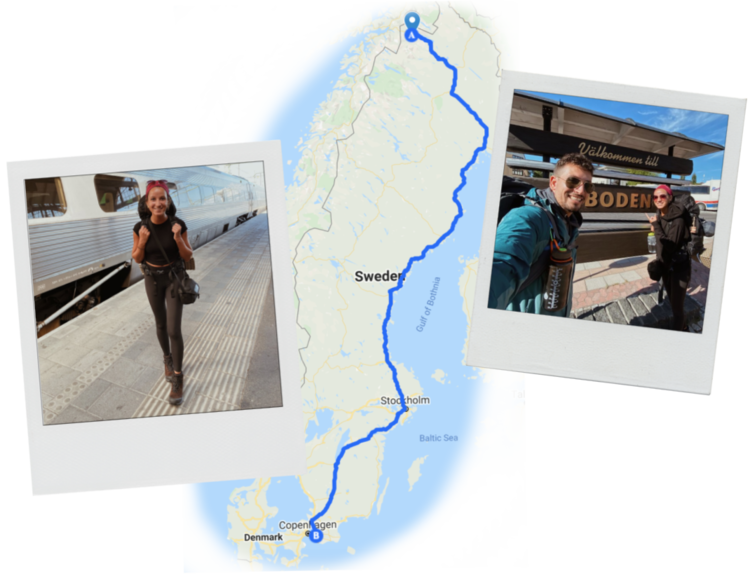
It took about 25 hours from Malmo to Abisko with a couple of stops along the way: First a train from Malmo to Stockholm, then an overnight train to Boden, and, finally, from Boden, another short train ride to Abisko Tourist Station.
First class train tickets are a bit more expensive depending on when you’re travelling… but SO worth it.
You get an actual bunk which is much more ideal than sitting upright/trying to find a comfortable sleeping position in second class. We “splurged” on a bunk on the way back and it was a million times better than our journey there. Pay the extra money. Whether you’re just starting or ending your trip, your body will thank you later.
Train journey tip: If you go with a second class ticket, have your camping gear handy. There are no bunks in second class, but, thankfully, the train traffic thinned out and most passengers had a full row to themselves (making it easier to attempt to stretch out).
It got super cold in the night, so I was glad my sleeping bag was attached to the outside of my backpack. I was able to grab it quickly (and quietly) and finally get some sleep once I curled up inside. If you can’t splurge on a first class ticket, having a sleeping bag or pillow accessible will make ALL the difference.
Now… let’s get on to the good stuff, shall we!?
The actual trek!
Hello, World!

ABISKO TO ABISKOJAURE

Before I knew it (aka 25 hours later), the train rolled to a stop at Abisko Tourist Station and the few remaining travellers, all obviously trekkers, got off to begin their Kungsleden journeys.
I was a bit worried we would get caught in a herd of people all moving at the same speed in the same direction down the trail, but this wasn’t the case at all... (thank god).
Andrew and I planned to go to the tourist office at the Abisko Mountain Station to buy a map and refill our water bottles before getting started, but, instead, found ourselves accidentally beginning the trek straight away.
Oops.
About 10 minutes in, I checked the offline mobile map I had downloaded to my phone to see how far we were from the tourist station… and realized it was actually on the opposite side of the train tracks.
Then I checked the time.
It was already 4:30 in the afternoon, and we were aiming to complete the first 15km stage of the trail.
Our train from Boden to Abisko had been a bit delayed, so we were about half an hour behind schedule.
“Screw the map?” I asked Andrew.
“Yup. Screw it. Let’s go,” he agreed. And so we went.
…But we didn’t make it very far before I was stopping for photos.
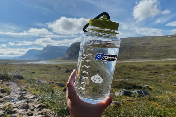
So far the trek was mostly through the woods, but we started to hear rushing water to our right, and, soon, came to a clearing and the most beautiful gushing river.
We had heard that fresh water wasn’t something you need to really worry about along the trail, but hadn’t anticipated for this to be confirmed so early on.
Suddenly, we were even more pleased with our decision to make the most of the remaining daylight hours and skip the detour to the fjällstation just to fill up on water and get a map.
Side note: The whole map thing DID become a bit of an issue a couple days later, but, at this point, we were feeling pretty happy about our decision to save time and do without. Silly, I know.
Andrew walked down to the water, dipped in our bottles, and lifted them out full of the clearest, purest, most refreshing mountain water I have ever seen… or tasted.

We walked through the trees and past the first of only two designated camping spots in Abisko National Park, but, determined to make it all the way to Abiskojaure before setting up camp, decided to continue on. Perhaps if I hadn’t stopped to take so many photos and videos, we would have made it there… but, oh well. Can you blame me? Abisko is INSANELY beautiful.
As the sun slipped behind the mountains, we decided to stop and make camp for the night - just 1km shy of our Day 1 goal.
Technically, you aren’t supposed to set up camp in the national park, but we did so out of sheer necessity. We saw a few other campers stopping, too and made sure to use a spot that had obviously been used as a campsite before.
I didn’t feel great about “breaking the rules” on day 1… but, honestly, we didn’t have much of a choice.
We set up camp, got water from the river, and boiled it for our gourmet freeze dried dinners… which, as it turns out, are actually surprisingly tasty.
The mosquitos were absolutely massive so we turned on our Thermacell repeller (which they didn’t seem to pay any mind) and put on our head nets to avoid swallowing any.
The only problem with wearing the headnets when eating is… having a headnet on while trying to eat. This was a bit tricky, but we sorted it out.
I would have liked to sit outside and enjoy the view, but, as soon as the sun went behind the mountains, the temperature dropped FAST and the mosquitos were relentless.
Instead, we changed out of our sweaty clothes, removed our hiking boots (the most satisfying feeling in the world at the end of a long trek day), and spent the rest of the evening in the tent… and when I say “the rest of the evening” I actually mean the next half an hour.
After finishing dinner, exhaustion soon took over and we both slipped off into a well deserved (almost fully horizontal) night’s sleep.
DIFFICULTY: EASY
In comparison with the days that followed, day 1 was a breeze.
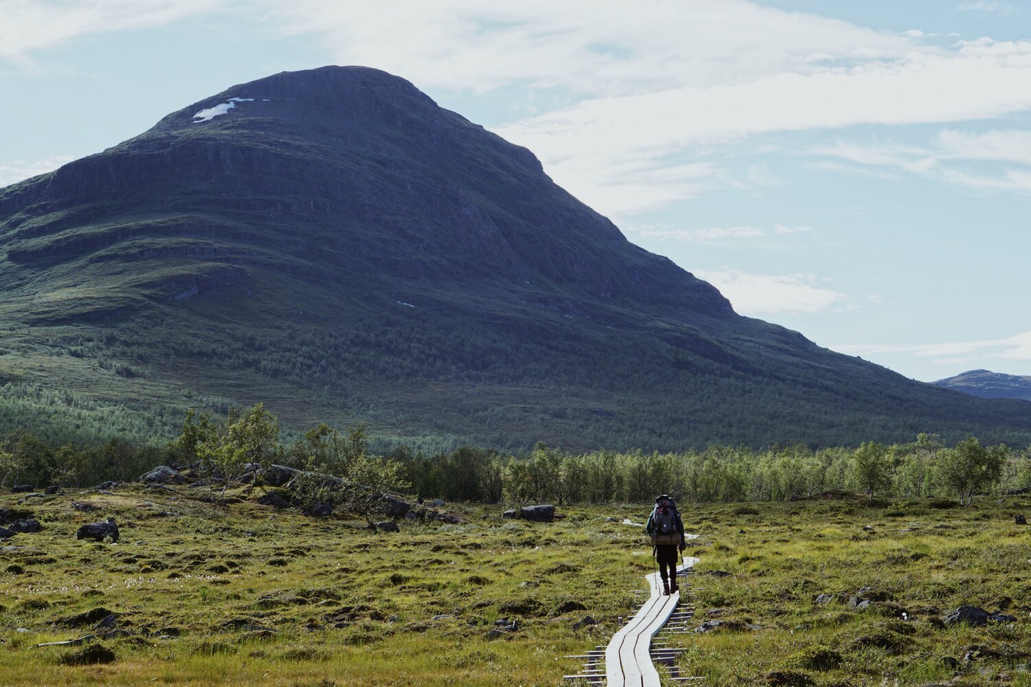
The winter and summer path are mostly the same through Abisko National Park (just follow the red sign posts) to stay on the right track. The trail at this section is very wide, well maintained, and not too steep. It follows the river through mountain birch forest, includes a few plank pathways, and isn’t too terribly rocky (something we encountered a lot more of in the coming days).
You can find more info about the National Park’s rules and regulations here.
Hello, World!

ABISKOJAURE TO ALESJAURE
On day 2 there were blisters… and slight regrets.
I now FULLY understand why breaking your hiking boots in properly ahead of time is so important.
We also regretted not having packed two sleeping bags… because our first night in the tent was COLD!
Like… alarmingly cold. Andrew didn’t admit it until later but we were both a tad concerned we’d die of frostbite or something.
Pro tip! If you’re planning to camp, make sure each person has their own sleeping bag (even if you think you should leave it at home to save space).
Don’t be fooled by the wonderfully, sunny pictures you may have seen of the trek. The weather can change VERY quickly, and, as soon as the sun goes down, it gets extremely chilly. You’ll definitely want to wrap up… in your own sleeping bag.
Side note: Being prepared and properly equipped for the elements is actually quite serious. On our way back to Malmo, we shared a train car with a man from Kiruna. He told us that, in recent years, helicopters are having to fly in for more and more rescues because people misguided by photos/blogs making it seem much warmer than it is didn’t pack the necessary clothes + gear. Don’t be like those people. You’re going to the Arctic Circle… pack accordingly!
Thankfully, we brought a couple of emergency blankets with us, which were surprisingly effective (and also terribly noisy if you made the slightest movement in the tent).
All that to say… The sleeping bag to person ratio should be 1:1.... And break in your boots ahead of time.
ANYYYY WHO… BACK TO DAY 2.
Despite the cold, mostly sleepless night, I woke up bright and early in the morning feeling surprisingly fresh and ready to go.
Perhaps it was the crisp mountain air, or maybe my eagerness to get out and see what our campsite and the surrounding mountains looked like bathed in the early morning sun. Probably the latter.
It was flippin’ beautiful… Maybe even more so than the previous evening!
Andrew on the other hand, was not quite so rested and lively.
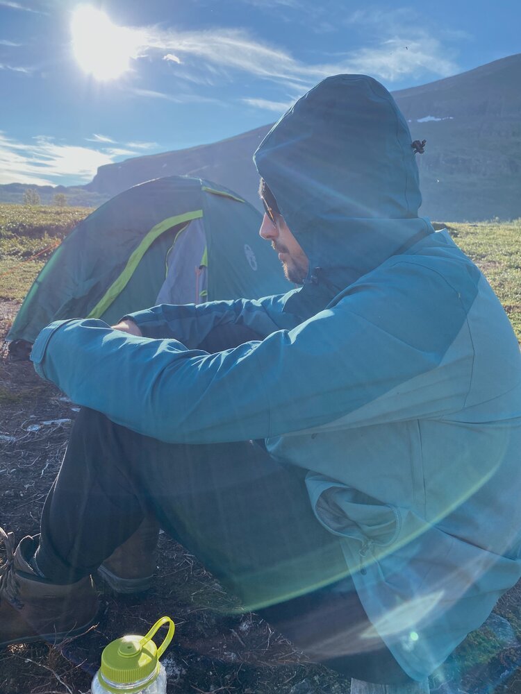
Pictured: a very cranky Andrew… Don’t worry, he was feeling much better after brekky.
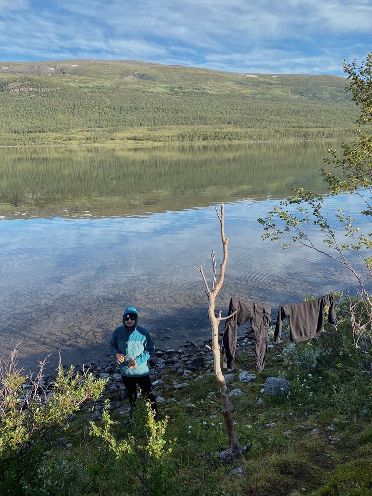
We strung up our clothes line between two trees and hung up our sweaty (now very damp) clothes to dry.
Turns out one of the reasons we got so cold the night before (aside from only having one sleeping bag) is because we hadn’t properly pinned down the windscreen of our tent… making everything in the tent (including us) damp with condensation by the morning.
AMATEURS, EH?
It was going to be a big day and we needed to get started as early as possible.
Since we hadn’t made it all the way to Abiskojaure the evening before, our plan was to make it even further than Alesjaure (the next mountain station) on day two.
Little did we know that this was one of the most challenging segments on the northern part of the trail.
I suppose this is something we could have (and should have) known if we (I) had done more thorough research about each stage ahead of time… but I suppose it wasn’t so bad to find out once we’d reached the end that what was (supposedly) the most intense stretch of the trip was over.
The main thing that makes this portion particularly challenging is the steep climb up the Kieronbacken early on in the hike.
While day 1 is almost entirely flat ground through the park with just a slight elevation increase of +120 meters, day 2 involves an elevation of +350 meters. The incline wasn’t particularly easy on our backs, legs, or my exponentially growing blisters, but, the good news is, the farther down the trail (and higher into the mountains you go), the better and more beautiful the views become.
Hello, World!
ALESJAURE FERRY BOAT
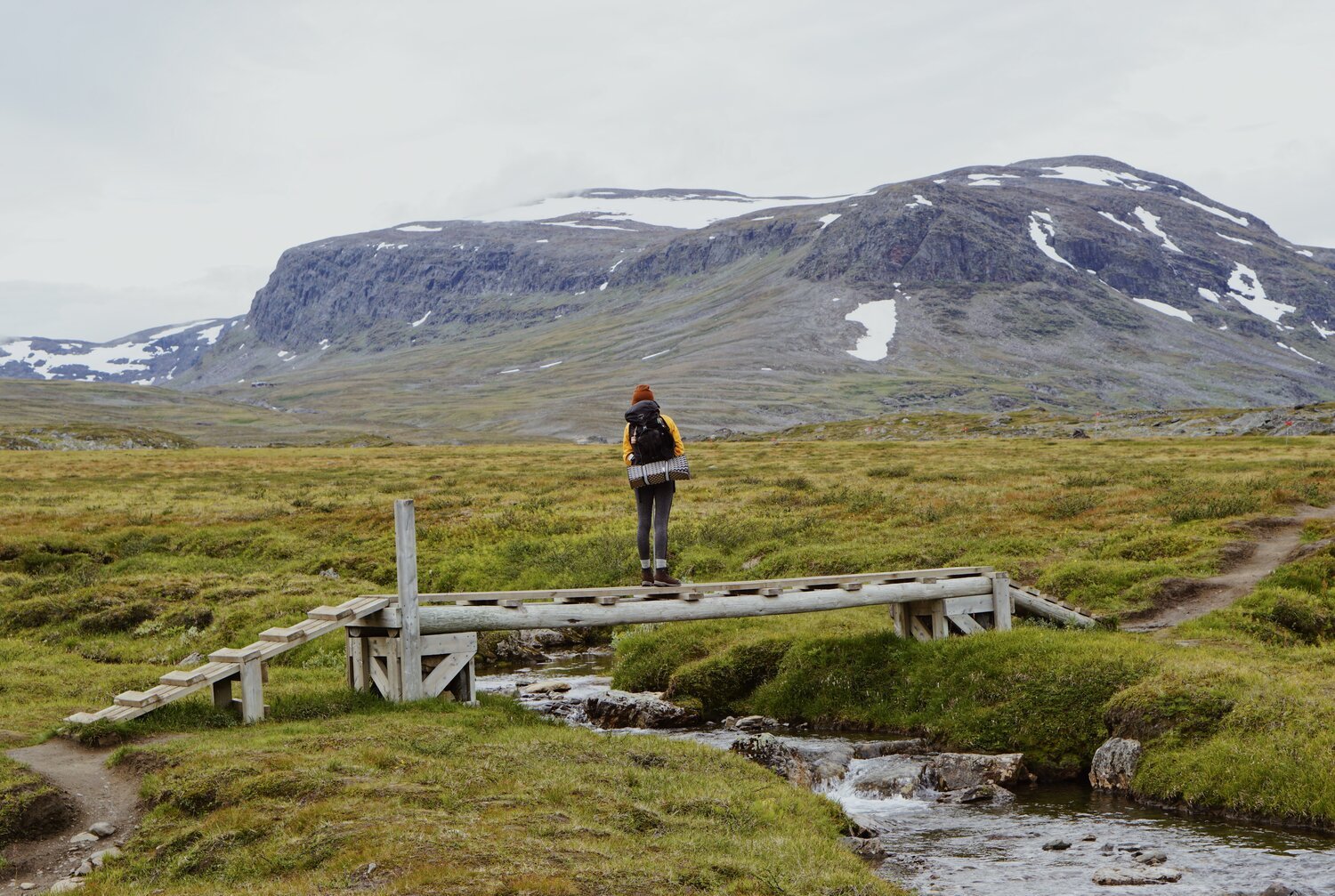
Eventually, we started to see glacier lakes in the distance, and, after another couple hours of trekking, spotted a sign for a ferry boat which was apparently only 5km away.
I used to run 5ks regularly while training for distance track and field races, so I was all like, “Cool, cool, coooollll - 5k. Piece of cake.”
Wellp, I was wrong. It was the. longest. 5k. of. my. life… butttt also had much nicer views than the 5ks I was used to.
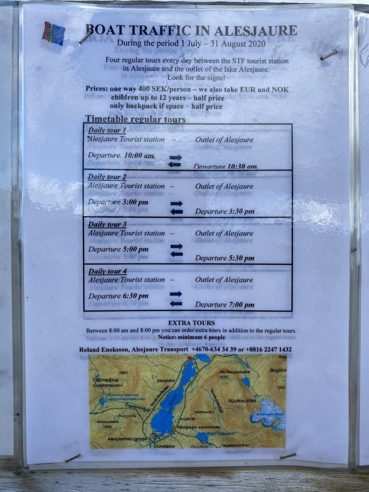
At 400sek per person, taking the boat across the lake is a bit pricy, but we were running out of daylight hours (once again) and decided it was worth it to splurge. This also meant cutting about 4km off this stretch of the trail, which… after nearly 10 hours of (mostly uphill) trekking, we weren’t at all mad about.
In the accompanying photo you’ll find information and timetables for boat trips to and from Alesjaure Tourist station.
Note this information is only valid through August 2020 and may be different in the future. For the most up to date information, contact the Alesjaure Tourist station directly.
Once we finally made it to the boat terminal, we were joined by a Polish man, two middle aged Swedish couples, and a group of four young lads. Thankfully, we all fit on the boat… but, we were scraping against the bottom of what turned out to be a very shallow glacial lake… and… fun fact the highest glacial lake in Sweden.
Taking the boat across provided a very interesting and informative break from trekking. The boat driver was local to the area and told us all about what to expect on the rest of the trek. He also told us about “Facebook Rock” - the only point to get solid cell service nearby. It was quite a ways away… so, as far as I know, none of us weary trekkers took him up on the offer.
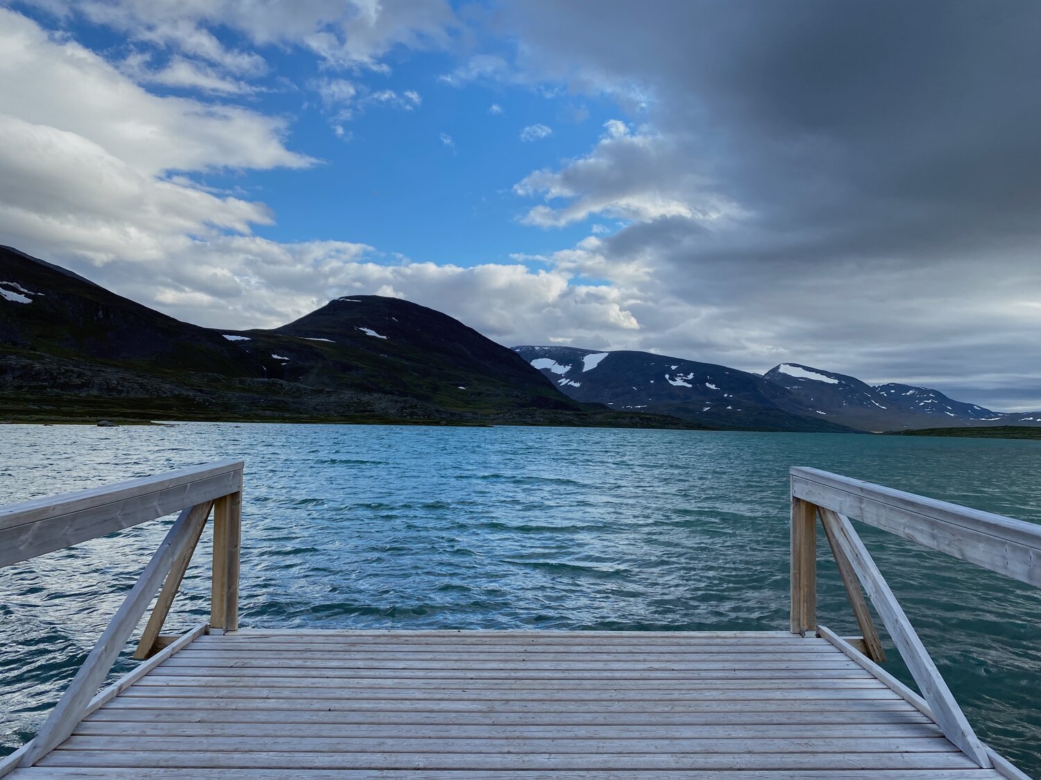
We passed the Laevas summer settlement on the east of the Alesjaure lake and, soon, we arrived at the STF mountain cabin at the southern end of the lake.
DIFFICULTY: HARD
The inclines on this stretch were extremely tough, so we ended up stopping for breaks quite a bit… but the views were amazing and well worth the aches and pains.
One thing to keep in mind is that once you go up into the mountains, there isn’t anywhere to stop for water for awhile. I know I said earlier that fresh water isn’t really an issue… BUT, this was the one stretch where it could be. Make sure to refill your water bottle while you can!
Hello, World!
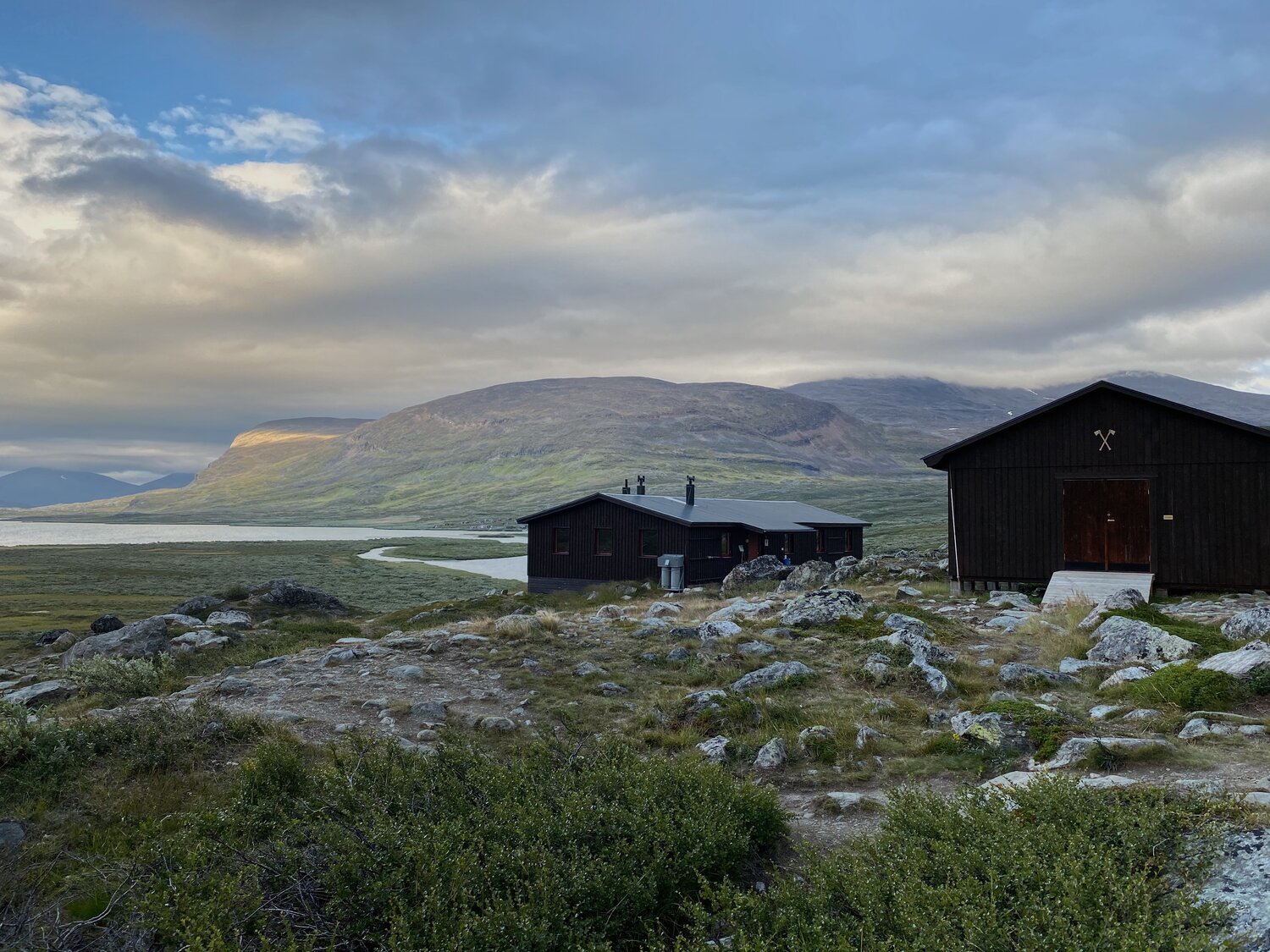
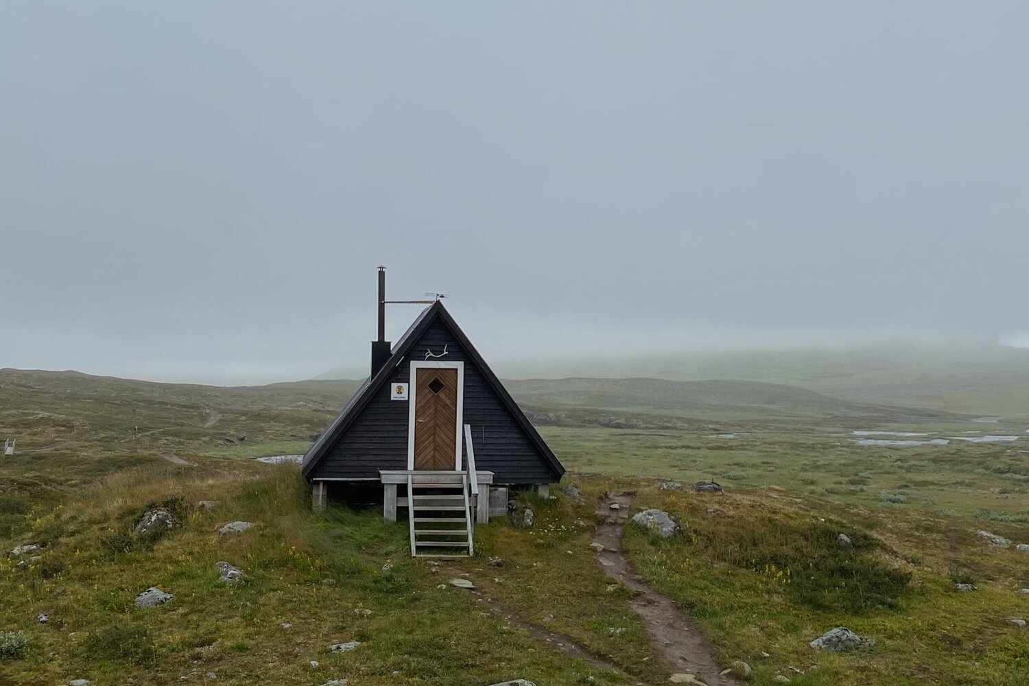
STF Alesjaure Fjällstuga
After speaking with one of the Swedish couples on the boat, Andrew was completely sold on staying the night at the fjällstation instead of camping out again.
What convinced him?
Well, one word…
FIREPLACE.
So we decided to go for that, too.
I was pretty happy with the decision too, and found it super nice to sleep in a bed. The sweeping lake and mountain views for miles were also a nice plus.
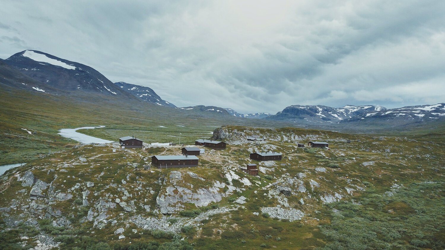
Thankfully, Alejsaure is the Swedish Tourist Organization(STF)’s largest mountain cabin station, and one of few stations with a store. We had no trouble setting up a place to stay on the spot, and were able to restock on food and folk öl (the beer that is not quite beer (as it’s under 3%… but still hits the spot after a long couple of trek days).
According to the STF website, reservations this summer should have been done in advance (bc corona times), but when space was available, we didn’t have an issue. The cabin hosts know people typically roam the trail without any set plans and were as accommodating as they could be.
For more information about becoming a member, check out the STF MEMBERSHIPS section below.
We chopped some wood (which is expected of guests staying in the cabins), played some cards, heated up some soup, drank our fake beers, and were out for the night. My expectations of the cabin bunk beds wasn’t too high, but DAMN I was pleasantly surprised by how comfortable they were.
The next day we were up bright and early to hit the trail again… and the outdoor tooth brushing views were CHEF’S. KISS. 10/10. Would definitely brush my teeth here again.
Side note: In the days that followed, we found that other STF Cabins weren’t so accommodating with last minute cancellations… they also may be a bit more strict on their booking in advance in the coming season, so that’s something to keep in mind when planning your trip.
For the most up to date information, visit the STF website.
Hello, World!

ALESJAURE TO SÄLKA
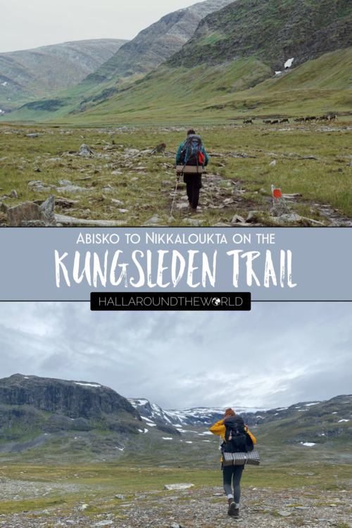
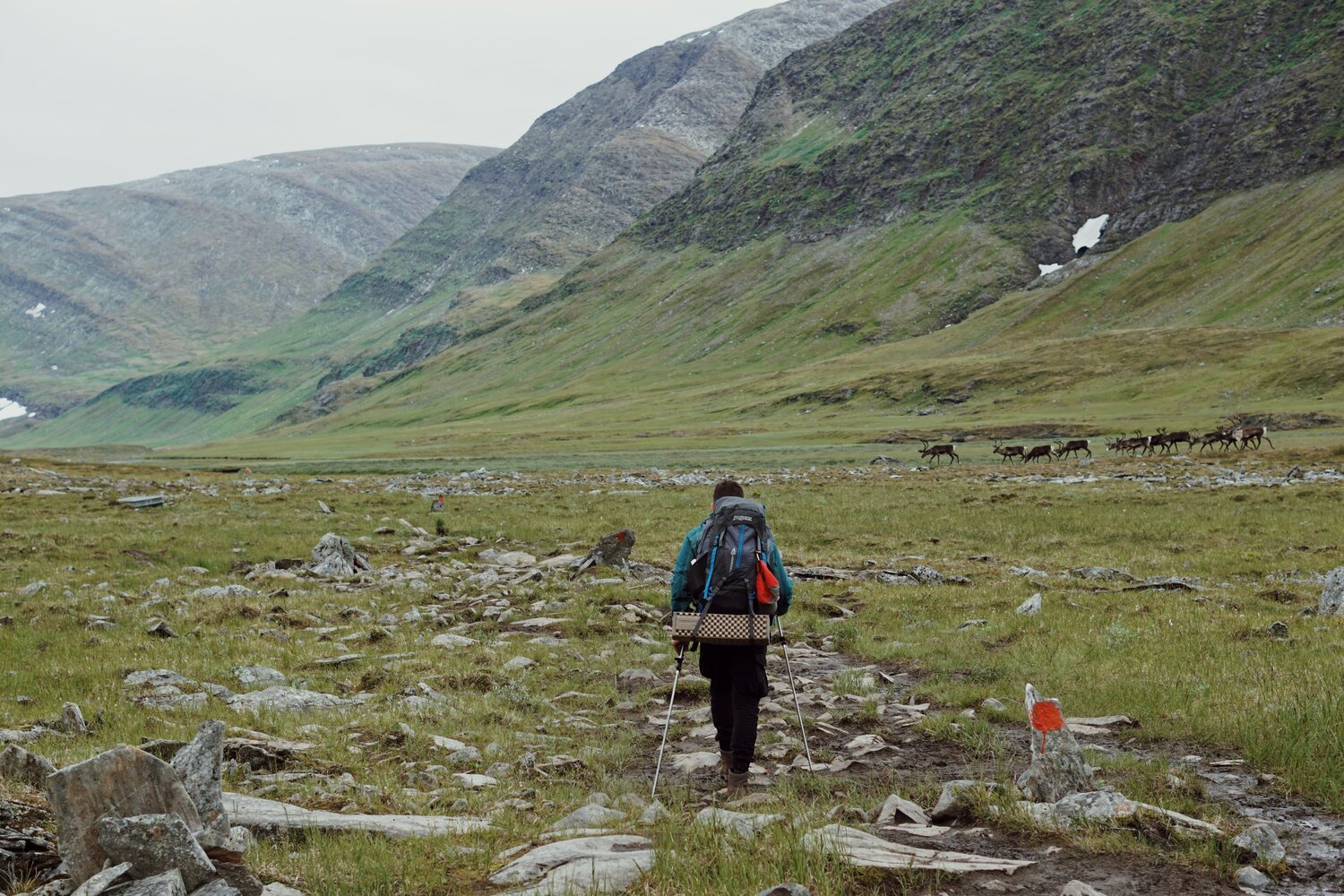
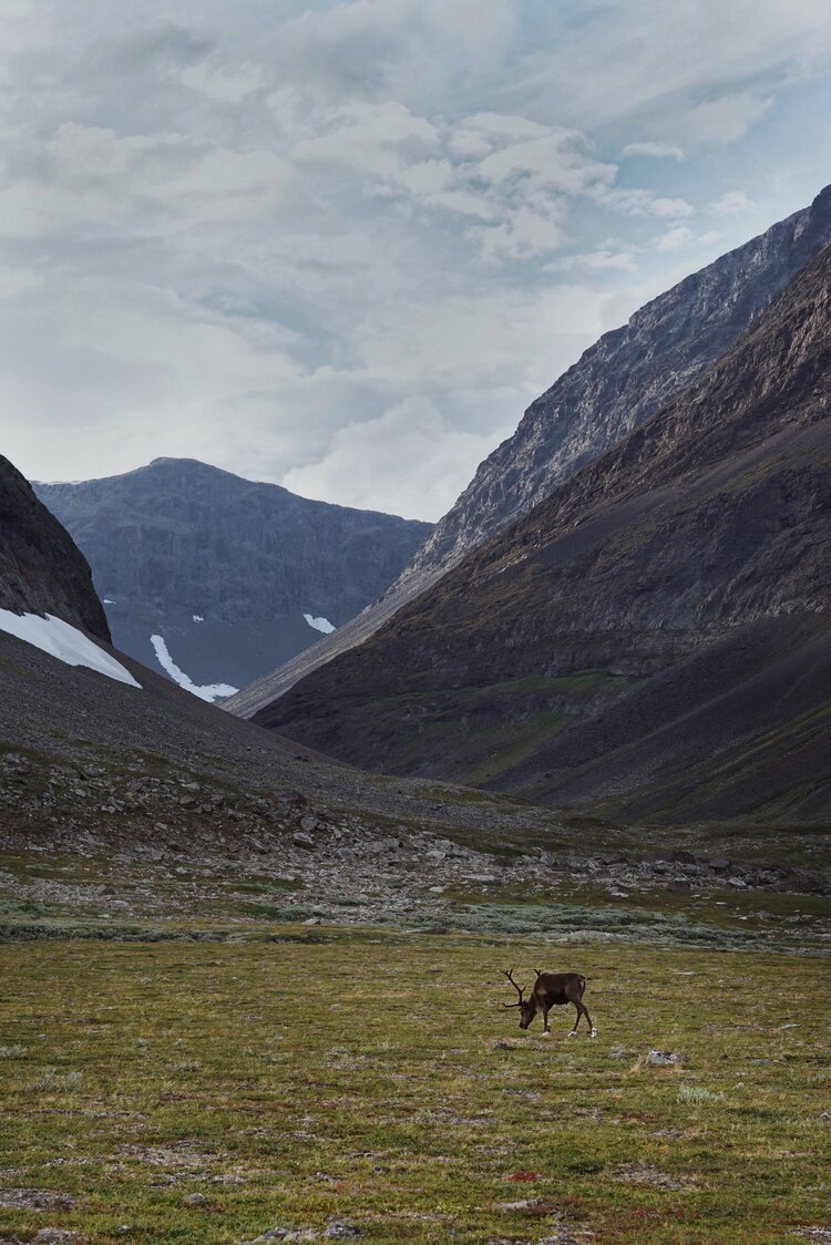
On day 3, I saw my first herd of wild reindeer… and realised I had forgotten to pack gloves.
So, I guess you could say it was a day of high highs and low lows.
I know what you’re thinking….
What kind of idiot goes on a camping trip in the Arctic Circle and doesn’t bring gloves!? And I was thinking the same thing.
The answer is… this one. This kind of idiot.
Thankfully, wool hiking socks aren’t just great for your feet… they also make for a wonderful pair of make shift gloves when you reach the highest pass of the trail, remember you are on a trek north of the arctic circle, and start to get extremely cold fingers.
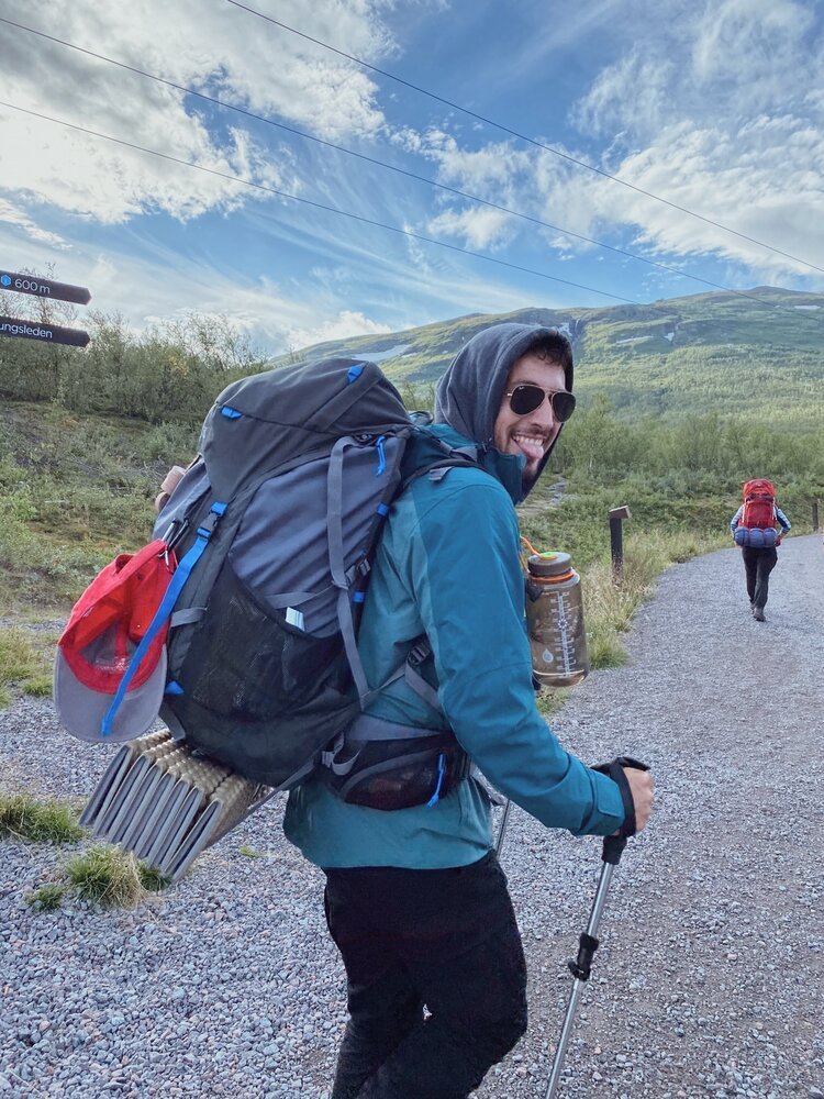
The only downside to my little “socks on my hands” get-up is that it made it really difficult to use my hiking poles (pics below, don’t worry).
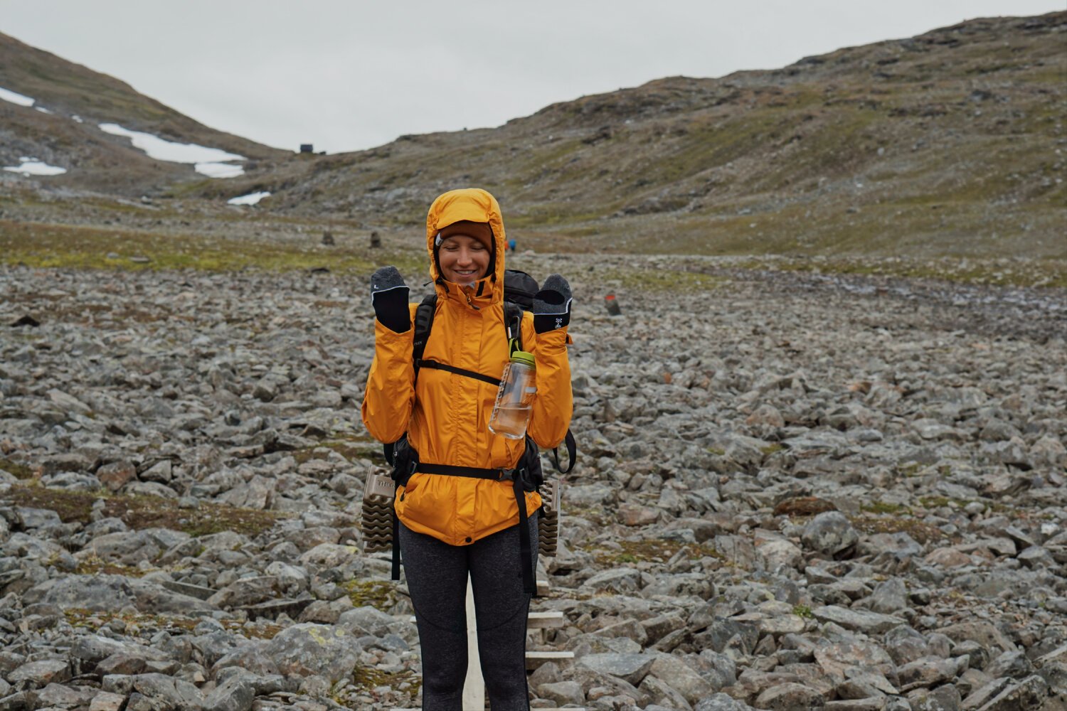
This also made me realize just how helpful the hiking poles are.
I put them away for a bit while warming up my fingies in my socks… and my knees did not appreciate it AT. ALL. The terrain was extremely rocky along this section (sometimes big boulders, and sometimes smaller tricky rocks), so you had to be careful and pay close attention to your footing. It would have been extremely easy to roll an ankle.
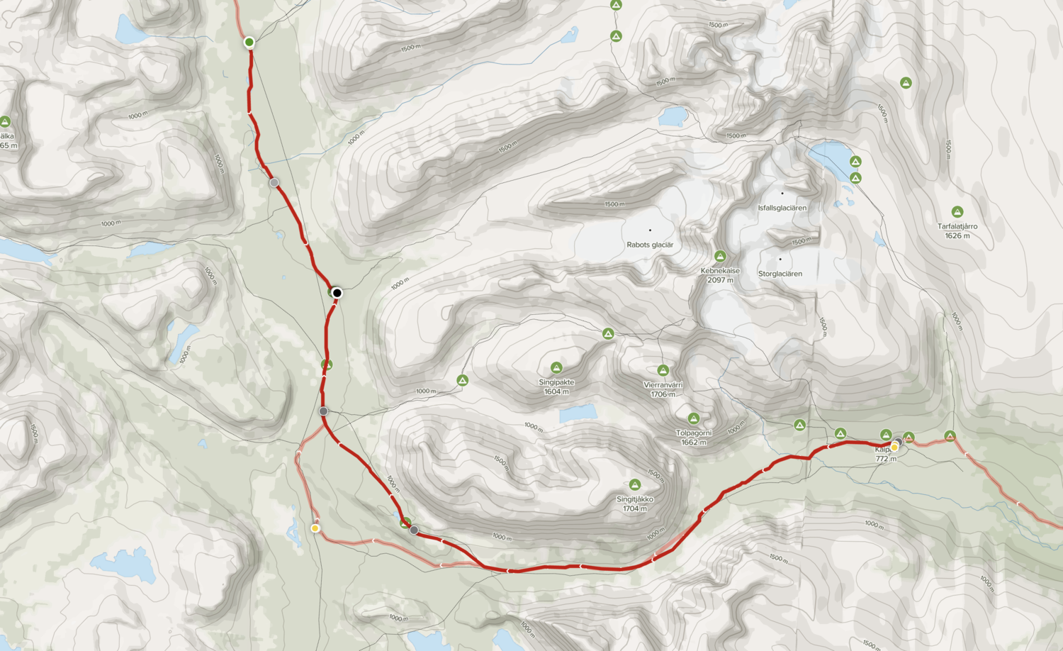
From Alesjaure, there are a couple different routes you can take.
You can either continue west towards Tjaktja (and on to Salka) like we did, or towards Vistas.
We planned to stay the night at Nallo cabin next, and the route from Tjaktja seemed to be a bit shorter. Little did we know that from Tjaktja to Nallo the trail was unmarked… and it was at this point (and only this point) that we wished we’d bought a map.
We were losing daylight hours fast, and didn’t want to risk off roading in the dark, so we continued on to Salka… which, to be honest, at this point, was extremely challenging.
This stretch wasn’t necessarily much more difficult than the last… but, I had mentally prepared myself for one distance/journey and what we ended up doing was quite a few km (and hours) more than that.
In retrospect, we probably should have planned to just stay a night at Tjakta before continuing on to Nallo… or going to Nallo via the trail at Vistas (which we found out after the fact IS marked).
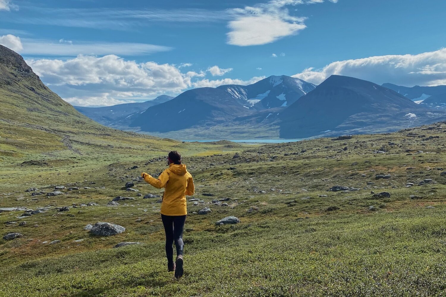
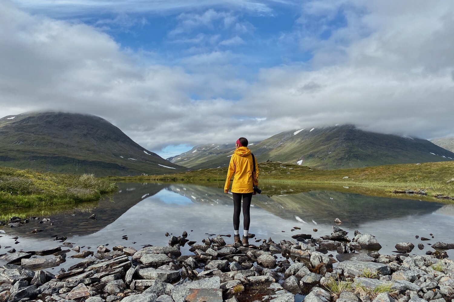
On the bright side, in terms of views, day 3 was amazing.
There were so many reindeer, AND when I was dying of the cold, Andrew stopped and cooked us up a well deserved trail-side lunch. Again - 10/10 views, would deffo reccommend.
DIFFICULTY: HARD
Of all the days on the trail, this was probably the most challenging for me… (partly due to my frozen appendages and our Nallo plans falling through)… but it was also one of the most jaw dropping.
Had we taken it a bit slower, I think the day would have been much easier.
Next time, I would absolutely go the other route to ensure we make it to Nallo via a marked path… or, ya know what, actually… next time I’ll just bring a map and a compass and start the trek days a bit earlier. That way, going off trail would feel a lot less daunting.
Hello, World!
STF Sälka Fjällstuga
After our plans to make it to Nallo fell through, we decided to continue on to the Fjällstuga at Sälka.
This is another of the larger stations with multiple cabins and a shop, so we were assured that they would have space and would be happy to swap our reservation we’d made at the other cabin.
Andrew went off to chop our share of the wood (which wasn’t really necessary as there was already loads in our cabin and even more stacked outside). I think the Canadian in him just really enjoyed swinging an ax and didn’t see this aspect of the cabin stay as a chore.
This was easily my favorite of all the STF cabins we stayed at along the way. The staff here were so friendly and greeted us with a delicious saft (juice). It was soooo refreshing and needed.
We had a couple of low percentage beers, made some soup for dinner, had a quick chat with our two cabin mates, and, after a couple of card games, went to our bunks for a well deserved nights sleep.
Hello, World!

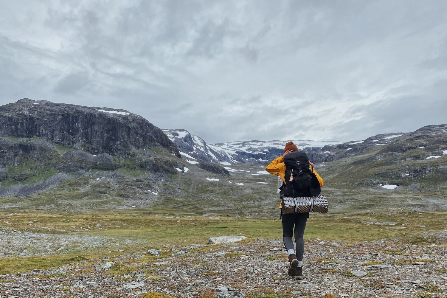
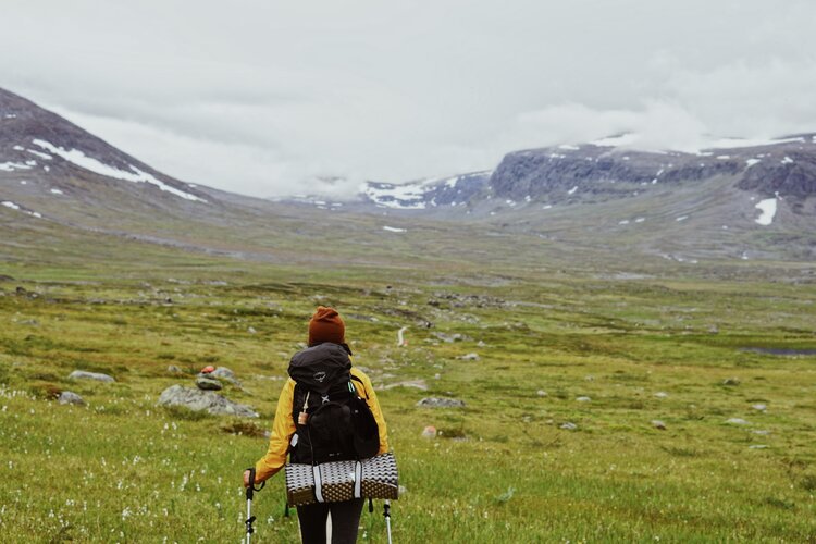
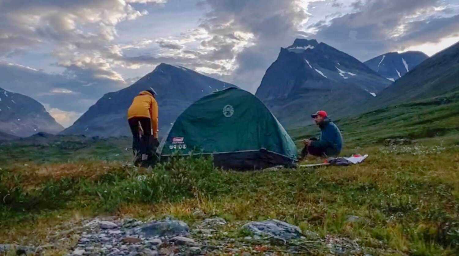
SÄLKA TO KEBNEKAISE
On day four, there were tears… and not the good kind… but that doesn’t mean it was a bad day.
I woke up early to do some writing in my journal and headed out to the outhouses for a morning pee. My legs were soooo stiff. Even walking the short distance to the outhouse was a mission. I probably should have made more of an effort to stretch at the beginning and end of each day.
We were determined to make it all the way to Kebnekaise Fjällstation, but our worn and weary bodies were feeling less and less up for the task.
We were two for two on not making it as far as we would have liked, which isn’t a great feeling to have. This is another big reason why I wish we’d had allocated more time for the trip - to get rid of that pressure altogether.
This was the warmest (dare I say hottest) day we had along the trail.
I was tempted to go for a swim in the glacial lakes and many of the other crystal clear pools of water we passed… but instead decided to just strip off a few layers. It was so nice out that we saw a few trekkers going topless and soaking up the sun.
This of course didn’t last, and the weather quickly became cool again.
But… I still wish I had gone for a swim.
Next time.
There are two routes you can take along this stretch of trail.
You can either continue on the trail left towards Singi, or take a mountain pass to the right that skips Singi. We opted to take this “short cut” that supposedly decreases this leg of the journey by 2-3km… though, I’m not really sure I buy it.
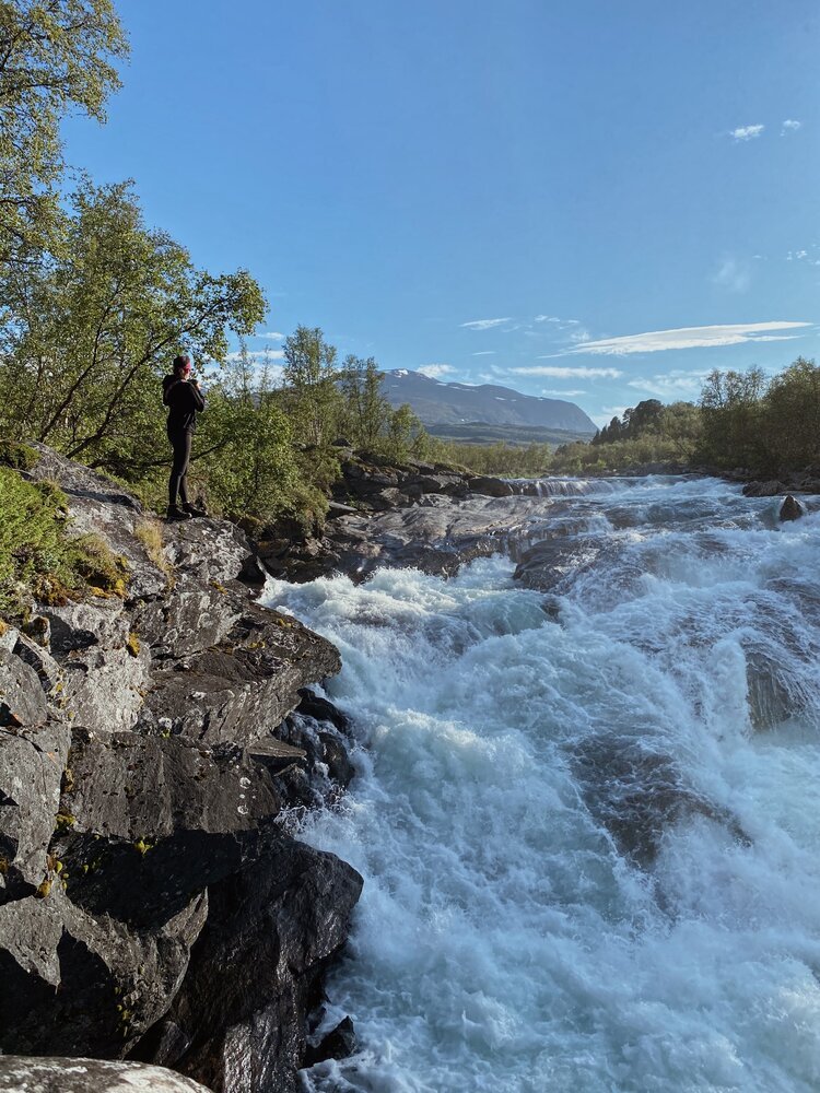
The initial incline on the short cut path was SO steep, but we were rewarded with amazing views, glacial lakes, and even a massive waterfall sighting once we reached the top.
After this, the terrain is pretty easy, though the trail isn’t as well maintained (I suppose because we weren’t technically on the summer trail).
The path takes you through a valley on what is mostly the winter trail. It’s doable in the summer, but, keep in mind, the winter trail is often quite marshy in the summer.
Making our way through the valley was really difficult… and quite wet.
The trail wasn’t very well managed at this point, which, again, was probably due to the fact that we had somehow ended up on the winter trail and not the summer one.
We had a few questionable water crossings and tried our best to follow the path that had been trod before us.
We passed a lot of people trail running from Kebnekaise which was a bit discouraging given our slow, exhausted pace.
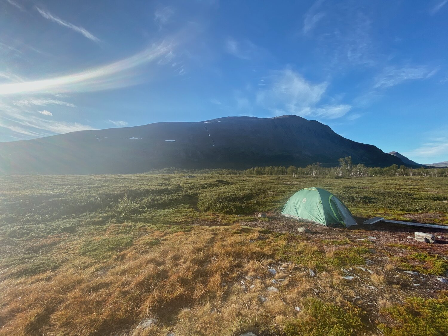
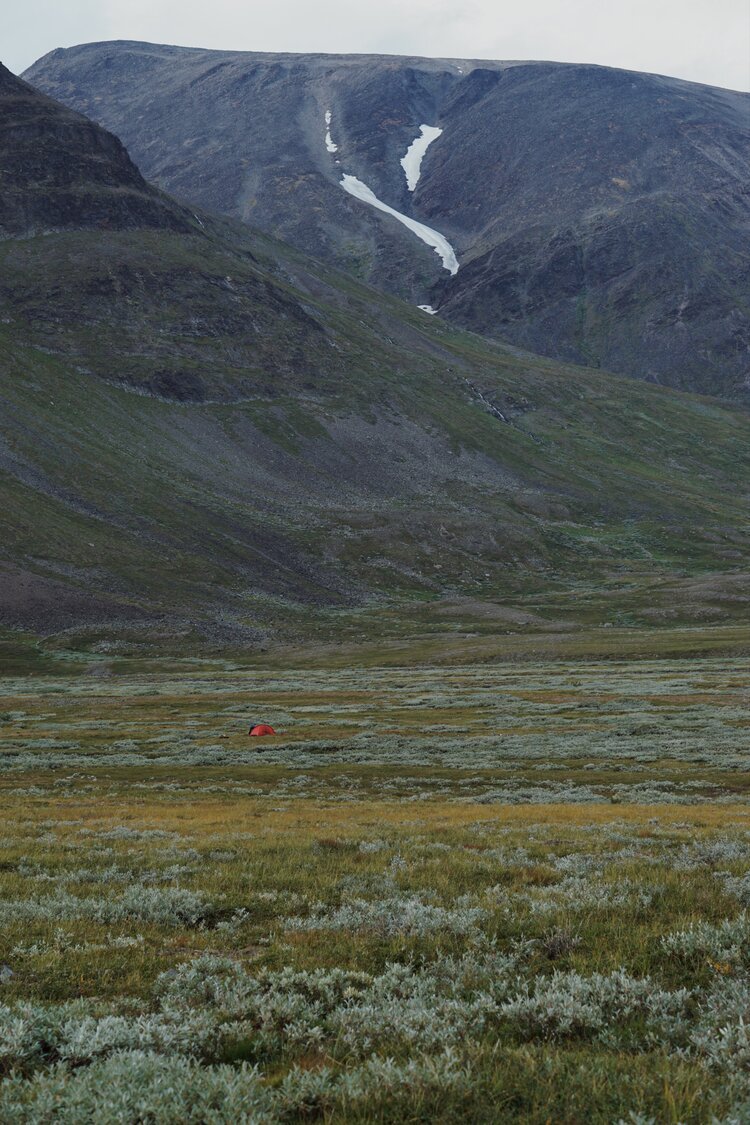
I had really been looking forward to getting to Kebnekaise and having a hot meal, but it just wasn’t in the cards for us. Our daylight hours had all but ran out, so we pitched our tent and called it a night.
We finally reached a good stopping point… and a bit of a mental breaking point as well.
We were both extremely hungry, extremely tired, and a bit disappointed to (yet again) not have made it as far as we wanted to for the day. The lesson here is that we were wayyy too overambitious with our daily distances and should have taken it a hell of a lot slower, but this was a realisation that has come much later as I piece this article together.
Little did we know we were setting up camp within sight of THE Kebnekaise, Sweden’s highest peak… which was a bit of a consolation after being so close to making it to the fjallstation (but still so far away).
In the end, it was better that we camped out here…
One, there weren’t any beds available at the fjallstation anyway.
Two, if we had camped in their vicinity we would have had to pay a fee for the night.
…and three - LOOK AT THE VIEW!
DIFFICULTY: MODERATE… BUT MOSTLY HARD
When I say that this day was hard, I mostly mean that it was mentally hard. Our “plans” had fallen through quite a bit at this point and we were both beginning to feel exhausted by the pace we were keeping. Physically, it wasn’t TOO bad. The weather was great, and, aside from the initial steep incline of the mountain pass shortcut we spent a lot of time going through valleys.
By the time we decided to set up camp, we were mentally and physically exhausted to the point of tears. I was also sad because I wanted wine, so there’s that.
Hello, World!

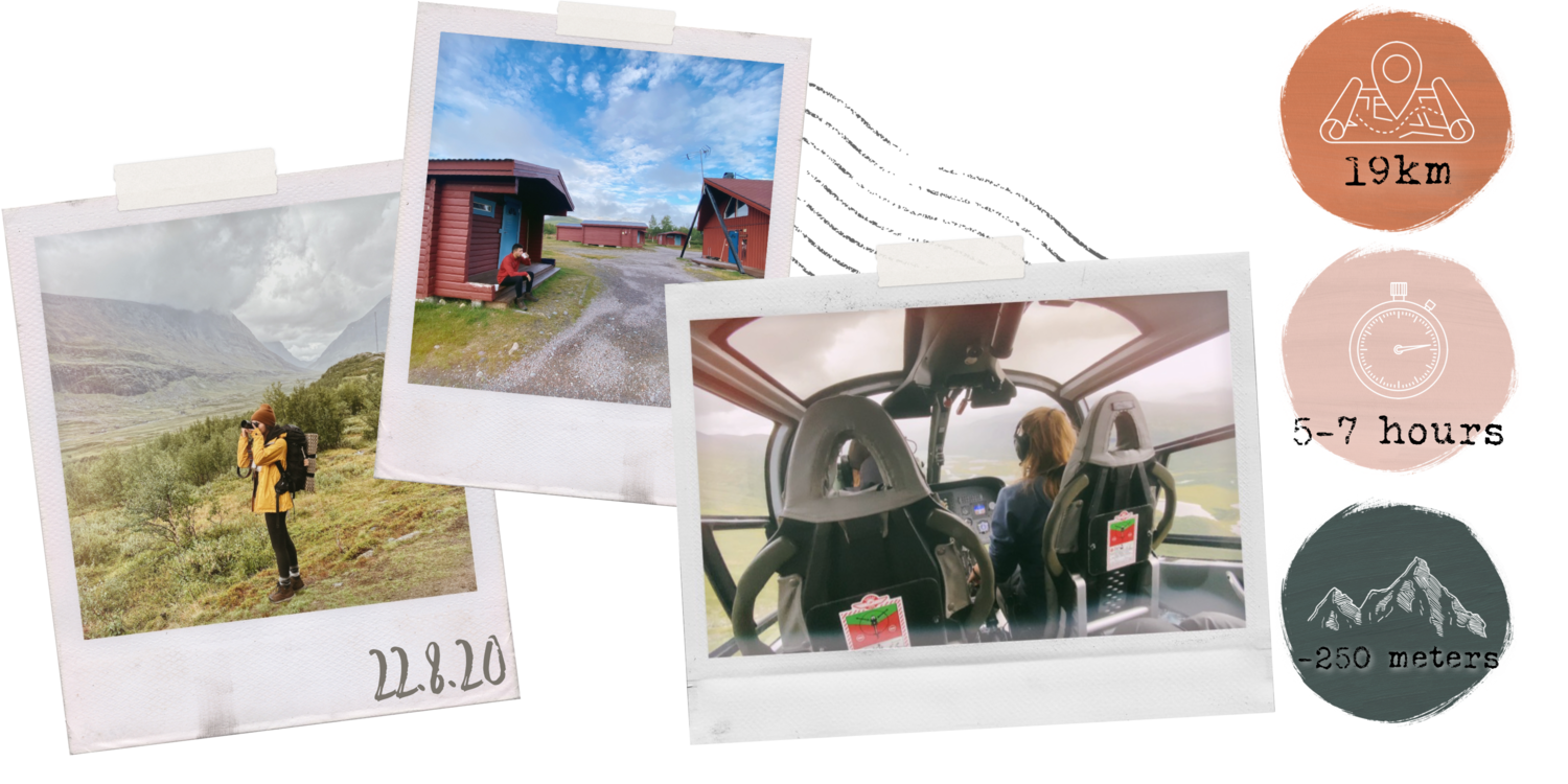
KEBNEKAISE TO NIKKALOUKTA
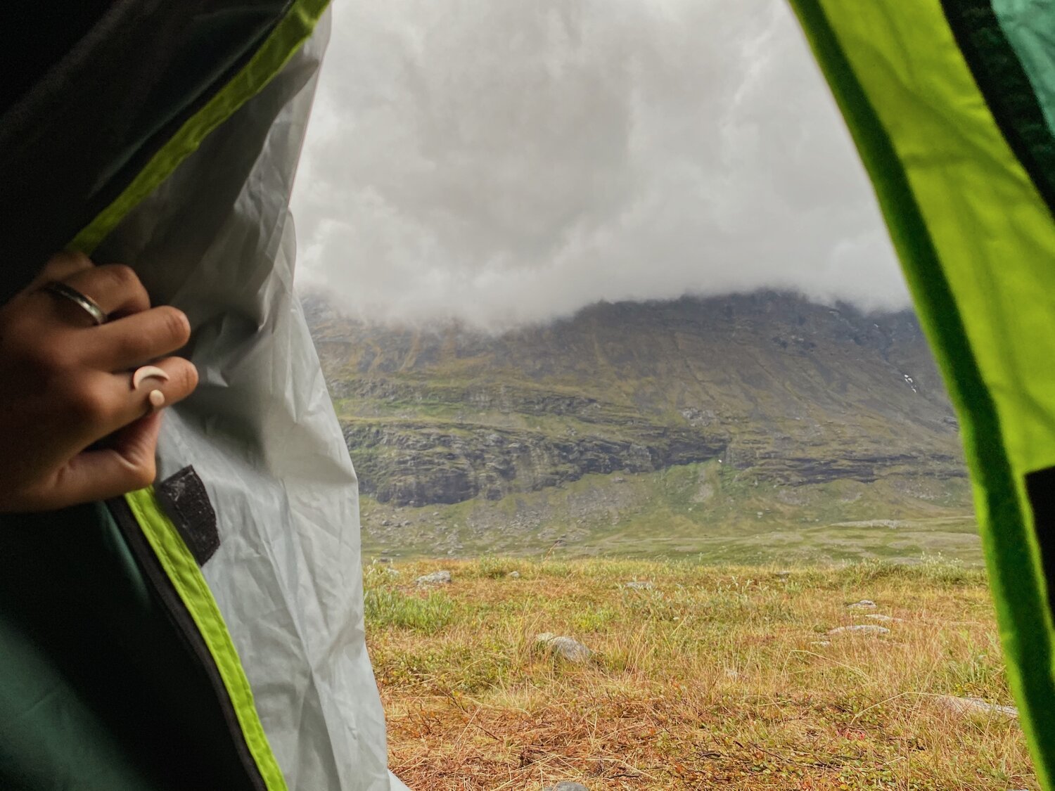
When we woke up the next morning, the weather was horrendous.
It wasn’t looking like an ideal day for another 20k, and after three back to back days of trekking 20+ kilometers, we weren’t feeling up for another 20k day either.
We were absolutely wiped…
…so, on day five, we kinda cheated.
In our defense, our tent had literally just about blown away with us in it in what was a torrential windstorm/downpour.
At this point, we were just about 1-2 kilometers away from Kebnekaise Fjallstation and, according to our phones which had started receiving data connection the night before, very close to civilisation… (which I had very mixed feelings about).
After some deliberation, we decided to end our trek at Kebnekaise instead of continuing on for the remaining 19km. A part of me regrets not technically “completing” the full stretch, butttt another part of me knows we desperately needed the break.
Next time, we will absolutely pace ourselves more and complete the full stretch… both for my own personal accomplishment reasons and because there’s a restaurant on the way called Enoks Restaurang about 5.6km (a 1.5hour hike) from Nikkaloukta that I’d really like to try. They were closed this summer because of COVID… which gave us even more reason to opt for a helicopter ride to Nikkaloukta instead.
This was a pretty big splurge for us… but we hadn’t really spent much on anything else in the previous few days. So, while holding our tent down with the weight of our bodies and backpacks, we had a bit of a YOLO moment and booked an evening spot on the chopper from Kebnekaise.
We packed what we could in the dimly lit tent and waited for the rain and winds to calm down. Finally there was a break in the storm, so we quickly took down the tent and packed what remained before making our way to STF Kebnekaise.
…but not before taking a few final photos.
I call this one… Rainman.
On our way to Kebnekaise it began pouring rain again, and, after having a few near tumbles along the way, we felt a lot better about the decision to end our trek here.
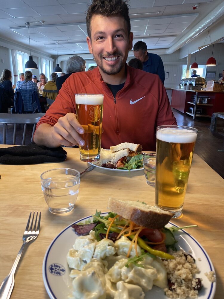
We spent the afternoon relaxing at the Fjallstation which was a great way to end the trip. We played some cards by the fireplace and enjoyed a buffet lunch and a couple of beers in the restaurant.
It was the first non-freeze dried meal we’d eaten all week and IT. WAS. GOOD… (but not quite as delicious as the meals we’d have in the next couple of days - more on that soon).
After a couple more beers and half a dozen card games later, it was time to head up to the helicopter base to fly the final stretch to Nikkaloukta.
It was my first time ever riding in a helicopter, so I was justifiably stoked.
Hello, World!
HELICOPTER RIDE WITH KALLAX FLYG
Since many people come to Kebnekaise mountain station solely to climb Kebnekaise, many opt to save their energy and fly in versus trekking the 19km from Nikkaloukta.
Kallax Flyg’s regular traffic between Nikkaluokta and Kebnekaise station departs twice daily during peak season and once daily during early and late summer. It is also possible to send just a backpack or other luggage in order to lighten the load for hikers who opt to walk from Nikkaluokta to Kebnekaise.
No reservation is required for the daily flights to and from Kebnekaise.
Tickets can be purchased 20 minutes before departure at either base or on our website. Everyone who purchases a ticket in time will have a seat and there is maximum number of passengers — They will make as many trips as necessary back and forth to get everyone to their destination.
In addition to their transfers between Nikkaloukta and Kebnekaise, Kallax Flyg offers other routine flights including a transfer from Abisko to Alesjaure and a number of scenic trips including a summit landing at Kebnekaise.
Check out their website for more detailed information: Kallax Flyg Sightseeing Flights
Hello, World!
Nikkaloukta Sarri AB
After arriving at the base in Nikkaloukta, we had a short walk to our accommodations for the night. There are a few different accommodation options close by (or you can of course bring your own tent).
We opted to stay in one of the cabins at Nikkaloukta Sarri AB where we enjoyed our first taste of reindeer… and our first shower in five days.
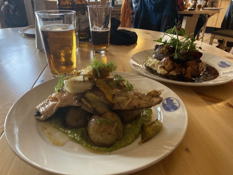
At Nikkaloukta Sarri, their Sami identity, culture and respect for the environment are ever present. I loved the rustic decor and photographs adorning each wall… but what really blew me away was their hospitality and the out of this world food served up at their on-site restaurant.
Their talented chefs prepare traditional dishes and new exclusive dishes. The menu offering varies depending on the season, but the base always includes fish, the reindeer, the moose, the berries - basically, what is in nature's pantry… And nothing goes to waste.
We had reindeer and a local fish dish and both were SO delicious.
After checking in and eating dinner, we called it a night early… again…
We turned on the radio and listened to whatever stations we could connect to while playing a few games of cards and then called it a night. There were also a few photo books with loads of old shots from around the area that were really cool to browse through.
Next time, I would definitely like to stay here longer to learn more about Sami history and culture.
For more information about this family owned business or to book your stay check out their website.
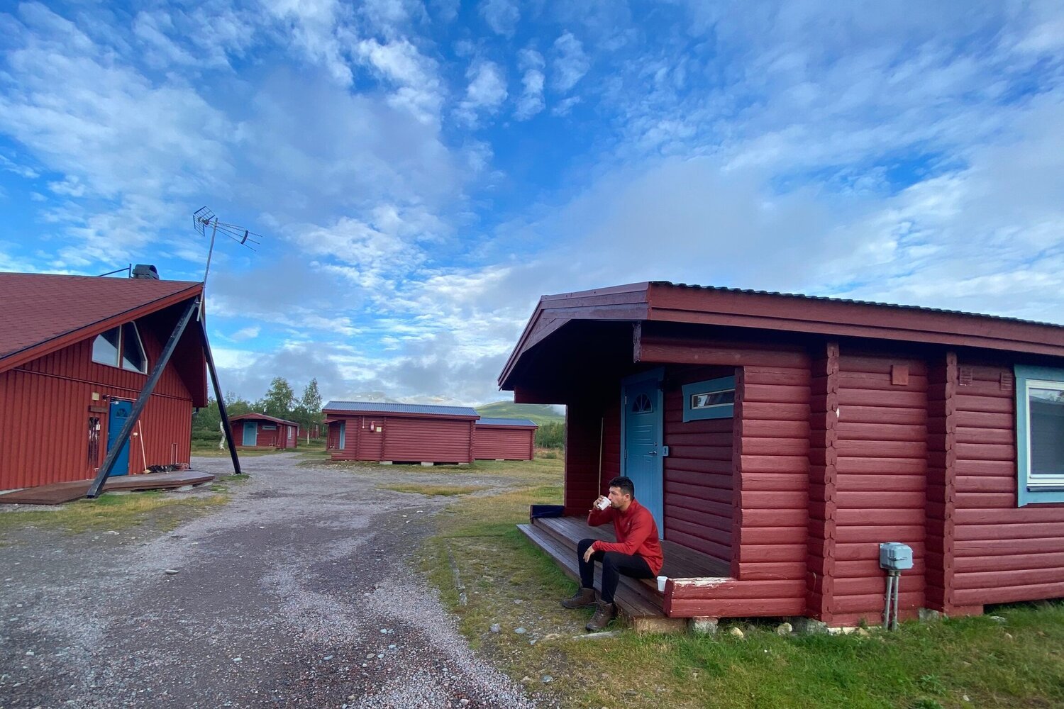
The next morning, we enjoyed a delicious take-out brekky on our cabins front porch. It was an interesting COVID solution to the buffet breakfasts they traditionally serve up in their restaurant… and, to be honest, I enjoyed this alternative much more.
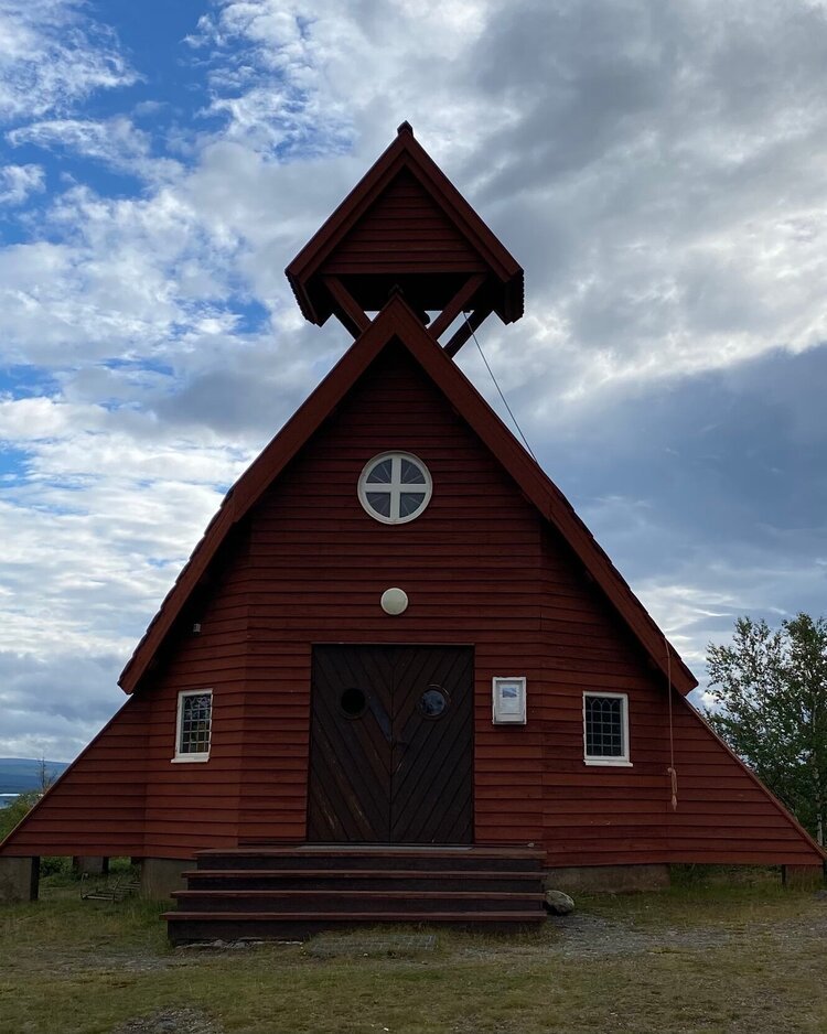
Our bus wasn’t coming until this afternoon so we had time to wander around Nikkaloukta a bit. After days of walking, you’d think we’d be sick of it… but we wanted to see as much as we could. We visited the Nikkaloukta chapel and wandered around the nearby lakes.
Just as it was time to go catch the bus to Kiruna, the rain began to fall.
Perfect timing.
Hello, World!

NIKKALOUKTA TO KIRUNA
Since we took the 5:15pm helicopter from Kebnekaise, it was impossible to get to Kiruna because the bus only ran twice a day, once in the early morning and again around noon. Unless you time your trek or helicopter trip absolutely perfectly, chances are you’ll need to stay overnight in Nikkaloukta.
The best way to get from Nikkalouka to Kiruna is on the Nikkaloukta Express bus. It will take you either to the city center or to the airport.
Updated bus timetables for this summer aren’t currently available, but they will be posted in March 2021. Head to their website for the most current ticket information.
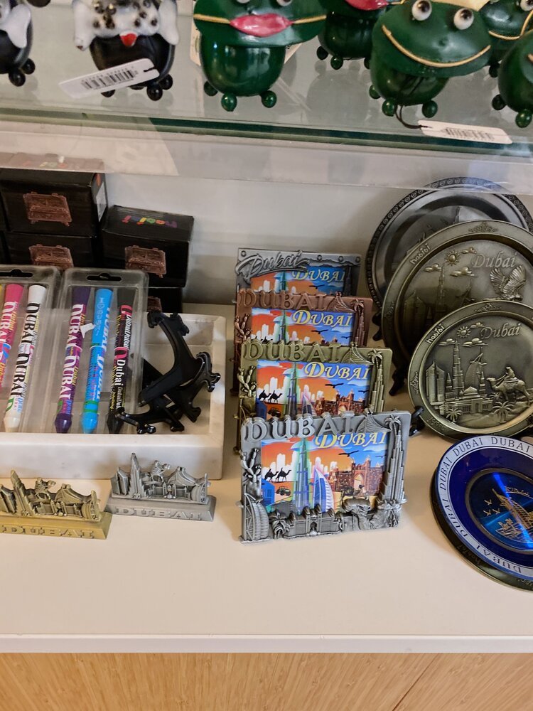
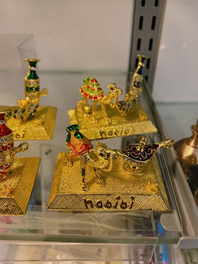
The bus journey takes about 1 to 1.5 hours including a pit stop along the way. We stopped at a random rest stop where we found an interesting array of souvenirs from both Sweden and… Dubai? Still not sure what that was all about but it gave us a laugh. Don’t ask me why, but my nickname for Andrew is habibi, so we almost came home with this inscribed camel.
Hello, World!
SPiS Hostel & Hotel - Kiruna
After arriving at the bus stop in Kiruna, we had a short walk to our place for the night - SPiS.
It is both a hotel and a hostel so you can splurge on an ensuite or save by bunking up.
All of their hotel rooms have a shower and toilet in the room (and communal showers + bathrooms for hostel guests). Guest also get access to the kitchen, sauna, and laundry room, and, in the morning, a free breakfast buffet is served in the restaurant.
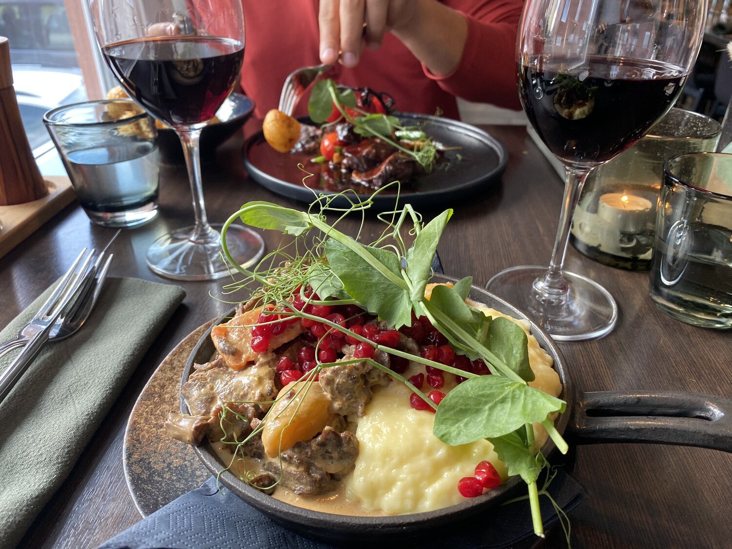
There is also a delicious on-site restaurant, bar, and a cafe and deli boutique. They had more beers to choose from than I’ve seen in AGES, so, it was tough to choose… but we ended up going with some local brews from Kiruna… and reindeer.
Honestly, we normally eat a strictly vegetarian diet… but… when in Lapland?
We had to try reindeer as least once… Or, in our case, twice.
Given my affinity for not eating meat or animal byproducts… I’m a bit sad to admit how delicious it was…
Overall, I loved it here.
My favorite thing about SPiS (other than the food and massive selection of craft beers) was the room decor. I loved the huge statement walls that are unique to each room. This time we stayed amidst a herd of reindeer… though, if you’re lucky, you could also sleep under a shot of the northern lights.
Head to their website to book your stay or to learn more about SPiS.
Hello, World!
STF MEMBERSHIP
Since 1885 the Svenska Turistföreningen (STF) - aka Swedish Tourist Association - has worked to promote outdoor life and knowledge among Swedes and visitors alike about the beauty of Sweden. The Association maintains a variety of trails, and offers unique accommodations including huts and hostels all over Sweden, (including, of course, along the Kungsleden).
I LOVE camping outdoors, but also really enjoyed staying in the STF cabins along the way. It gave us a break from the elements and allowed us to get a solid nights rest before continuing the trek. There was also oneeee more thing that easily sold us — wood fireplaces in each room.
All of the huts and larger mountain stations were well maintained by friendly and knowledgable staff who were happy to answer any questions we had about what to expect on the upcoming stages.
If you’re a beginning trekker and aren’t keen on carrying loads of camping gear with you, this is a great alternative to both break up the trek and to lighten your load.
Prices vary between different mountain stations depending on the time of the year, but with an STF membership you ensure you’ll get the lowest prices. You can also get a discounted rate on boat trips, meals, and products, as well as the cost of hiring certain sports equipment.
In the end, we decided to get the family membership and ended up saving about 100kr per person on our cabin bookings. This amount will definitely add up over time (but only really makes sense if you go this route from the start).
CURRENT MEMBERSHIP FEES ARE AS FOLLOWS:
Adult (26+): 345sek
Youth (16-25): 195sek
Child (5-15): 50sek
Family (max 2 adults + all children/young people registered at the same address): 550sek
Membership doesn’t just save you money, it also goes to a good cause. Profits are put back into the association and help make tourism in Sweden more sustainable.
For updated membership info and to browse all accommodations, check out the STF website in Swedish or English.
Hello, World!
Last, but most certainly not least...
Adventures on Film!
Check out the Kungsleden video trailer below, and subscribe to be the first to know when the full day by day trek video drops on YouTube!
If you have questions about the trek that weren’t answered in this post, let me know in the comments below and I’ll be sure to answer them in the upcoming video!


Planning a trip to Swedish Lapland?